> ## Documentation Index
> Fetch the complete documentation index at: https://docs.tilebox.com/llms.txt
> Use this file to discover all available pages before exploring further.
# Ingest into a spatio-temporal catalog
> Prepare GeoParquet metadata and ingest it into an existing Tilebox spatio-temporal catalog.
Use this guide after [Build a spatio-temporal catalog](/guides/datasets/build-spatiotemporal-catalog). It assumes you already created a spatio-temporal dataset and now want to load geospatial metadata into one of its collections.
The example starts from a GeoParquet file, reshapes it to match the catalog schema, ingests it into Tilebox, and runs a time and location query against the new collection.
If your source data uses a different file format, see [Ingesting from common file formats](/guides/datasets/ingest-format) for examples of loading CSV, Parquet, GeoParquet, and NetCDF data before ingestion.
## Prerequisites
* You have a [Tilebox API key](/authentication).
* You have installed the [Python SDK](/sdks/python/install).
* You have created the catalog from [Build a spatio-temporal catalog](/guides/datasets/build-spatiotemporal-catalog), or an equivalent spatio-temporal dataset with matching fields.
```bash theme={"system"}
uv add tilebox geopandas lonboard shapely
```
## Download the example metadata
The example metadata is available as a [GeoParquet](https://geoparquet.org/) file:
```bash theme={"system"}
curl -L \
-o modis_MCD12Q1.geoparquet \
https://storage.googleapis.com/tbx-web-assets-2bad228/docs/data-samples/modis_MCD12Q1.geoparquet
```
This file contains MODIS land cover product metadata, including timestamps and product footprints.
## Read and preview the source data
Read the GeoParquet file with Geopandas. The resulting `GeoDataFrame` includes a `geometry` column, which Tilebox uses for spatial indexing in spatio-temporal datasets.
```python Python theme={"system"}
import geopandas as gpd
source = gpd.read_parquet("modis_MCD12Q1.geoparquet")
source.head(5)
```
```plaintext Output theme={"system"}
time end_time granule_name geometry horizontal_tile_number vertical_tile_number tile_id
0 2001-01-01 00:00:00+00:00 2001-12-31 23:59:59+00:00 MCD12Q1.A2001001.h00v08... POLYGON ((-180 10, -180 0, -170 0, ... 0 8 51000008
1 2001-01-01 00:00:00+00:00 2001-12-31 23:59:59+00:00 MCD12Q1.A2001001.h00v09... POLYGON ((-180 0, -180 -10, ... 0 9 51000009
```
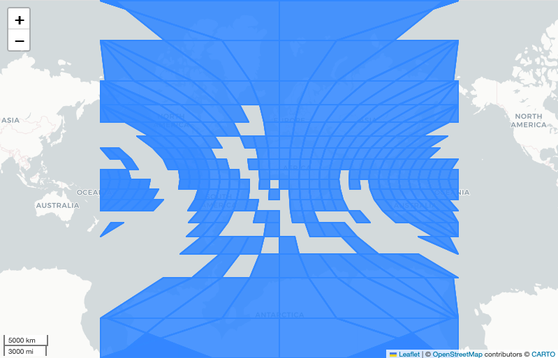
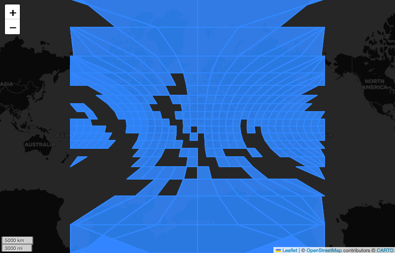
You can inspect the footprints before ingestion with `lonboard`.
```python Python theme={"system"}
from lonboard import viz
viz(source, map_kwargs={"show_tooltip": True})
```
 ## Match the catalog schema
Prepare a DataFrame with the fields required by the catalog. This example targets the schema from [Build a spatio-temporal catalog](/guides/datasets/build-spatiotemporal-catalog): `time`, `geometry`, `product_id`, `location`, `cloud_cover`, and `processing_level`.
```python Python theme={"system"}
products = source.copy()
products["product_id"] = products["granule_name"]
products["location"] = products["granule_name"].map(
lambda name: f"modis://MCD12Q1/{name}"
)
products["cloud_cover"] = 0.0
products["processing_level"] = "MCD12Q1"
products = products[
["time", "geometry", "product_id", "location", "cloud_cover", "processing_level"]
]
products.head(5)
```
Keep the DataFrame columns aligned with the dataset schema. Required fields such as `id` and `ingestion_time` are generated by Tilebox during ingestion, so you do not include them in the input DataFrame.
## Connect to the catalog collection
Access the catalog dataset and create or reuse a collection for the MODIS products.
```python Python theme={"system"}
from tilebox.datasets import Client
client = Client()
dataset = client.dataset("internal_imagery_catalog")
collection = dataset.get_or_create_collection("modis_land_cover")
```
Replace `internal_imagery_catalog` with the code name of your catalog if you used a different value in the previous guide.
## Ingest the products
Ingest the prepared DataFrame into the collection. Tilebox validates each row against the dataset schema before storing it.
```python Python theme={"system"}
datapoint_ids = collection.ingest(products)
print(f"Successfully ingested {len(datapoint_ids)} datapoints.")
```
```plaintext Output theme={"system"}
Successfully ingested 7245 datapoints.
```
## Query the ingested catalog
After ingestion, query the collection by time and location. The query model is the same one used by Tilebox open data catalogs.
```python Python theme={"system"}
from shapely import Polygon
area = Polygon(
[
(-124.45, 49.19),
(-120.88, 29.31),
(-66.87, 24.77),
(-65.34, 47.84),
(-124.45, 49.19),
]
)
matches = collection.query(
temporal_extent=("2015-01-01", "2020-01-01"),
spatial_extent=area,
)
matches[["product_id", "processing_level", "location"]]
```
```plaintext Output theme={"system"}
Size: 18kB
Dimensions: (time: 110)
Coordinates:
* time (time) datetime64[ns] 2015-01-01 ... 2019-01-01
Data variables:
product_id (time) object 'MCD12Q1.A2015001.h10v03...' ...
processing_level (time) object 'MCD12Q1' 'MCD12Q1' ...
location (time) object 'modis://MCD12Q1/MCD12Q1.A2015001...' ...
```
## View the data in the Console
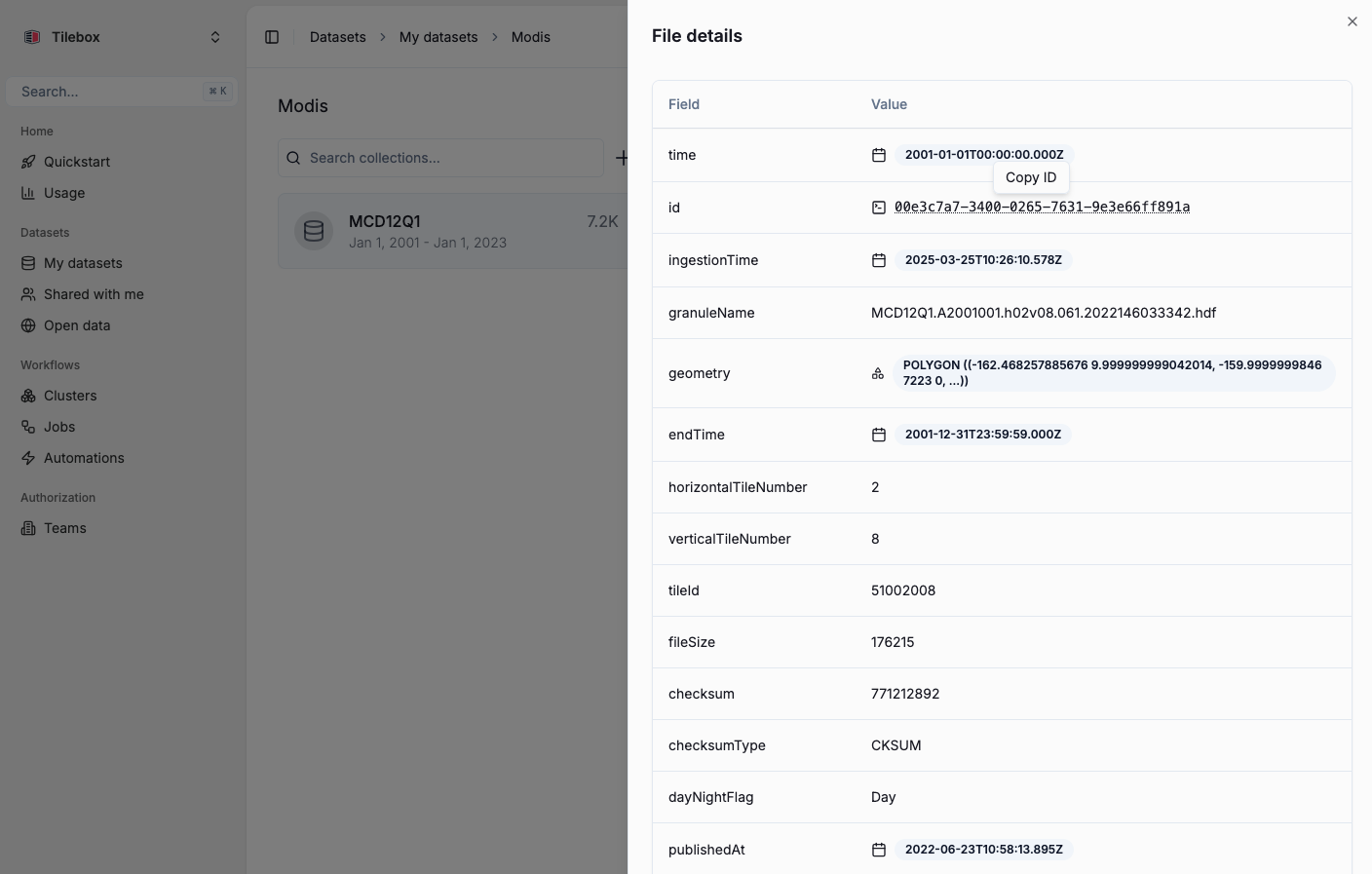
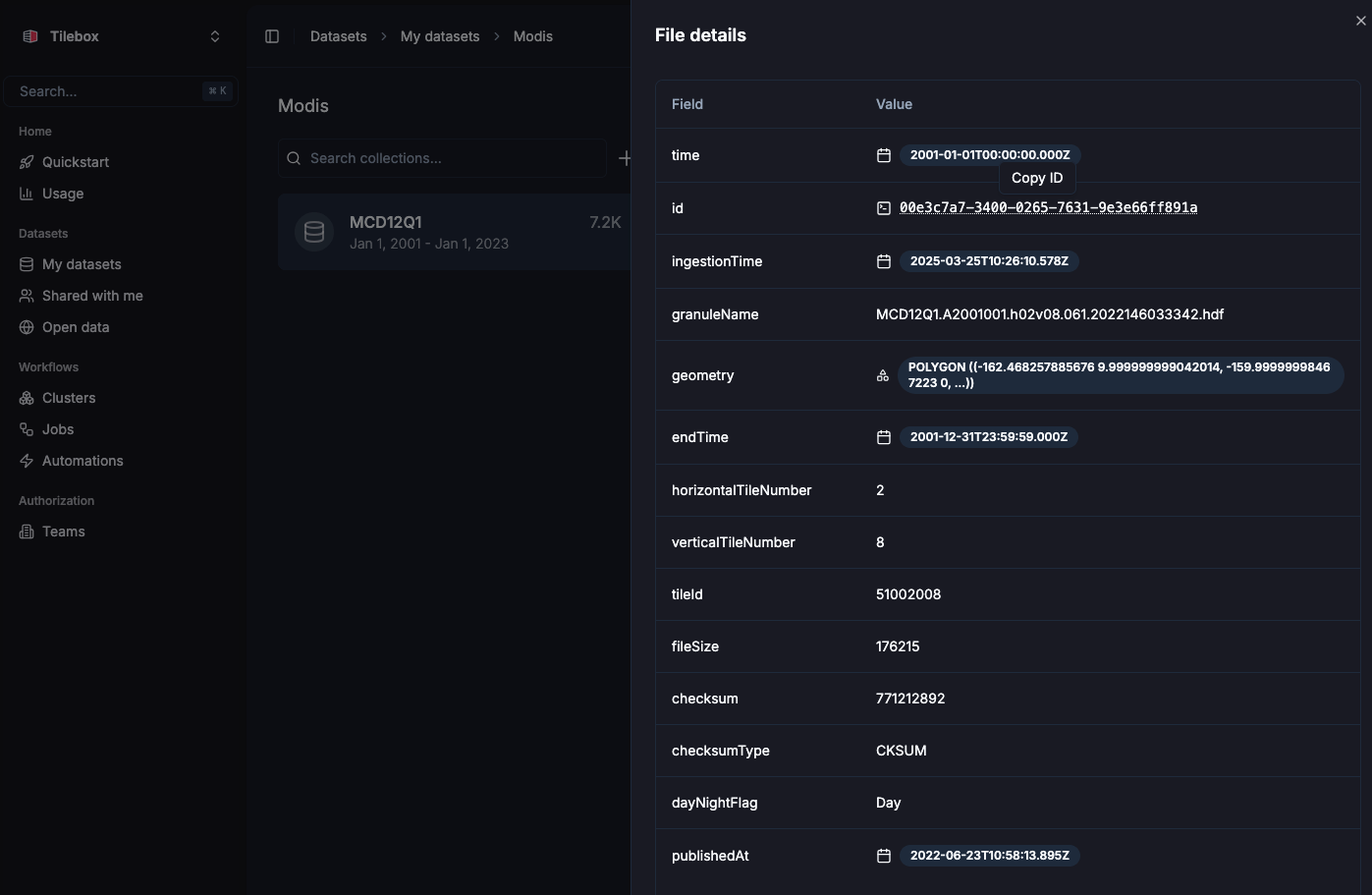
You can also inspect ingested datapoints in the Tilebox Console. Open the dataset, select the collection, and click a datapoint to inspect its fields and geometry.
## Match the catalog schema
Prepare a DataFrame with the fields required by the catalog. This example targets the schema from [Build a spatio-temporal catalog](/guides/datasets/build-spatiotemporal-catalog): `time`, `geometry`, `product_id`, `location`, `cloud_cover`, and `processing_level`.
```python Python theme={"system"}
products = source.copy()
products["product_id"] = products["granule_name"]
products["location"] = products["granule_name"].map(
lambda name: f"modis://MCD12Q1/{name}"
)
products["cloud_cover"] = 0.0
products["processing_level"] = "MCD12Q1"
products = products[
["time", "geometry", "product_id", "location", "cloud_cover", "processing_level"]
]
products.head(5)
```
Keep the DataFrame columns aligned with the dataset schema. Required fields such as `id` and `ingestion_time` are generated by Tilebox during ingestion, so you do not include them in the input DataFrame.
## Connect to the catalog collection
Access the catalog dataset and create or reuse a collection for the MODIS products.
```python Python theme={"system"}
from tilebox.datasets import Client
client = Client()
dataset = client.dataset("internal_imagery_catalog")
collection = dataset.get_or_create_collection("modis_land_cover")
```
Replace `internal_imagery_catalog` with the code name of your catalog if you used a different value in the previous guide.
## Ingest the products
Ingest the prepared DataFrame into the collection. Tilebox validates each row against the dataset schema before storing it.
```python Python theme={"system"}
datapoint_ids = collection.ingest(products)
print(f"Successfully ingested {len(datapoint_ids)} datapoints.")
```
```plaintext Output theme={"system"}
Successfully ingested 7245 datapoints.
```
## Query the ingested catalog
After ingestion, query the collection by time and location. The query model is the same one used by Tilebox open data catalogs.
```python Python theme={"system"}
from shapely import Polygon
area = Polygon(
[
(-124.45, 49.19),
(-120.88, 29.31),
(-66.87, 24.77),
(-65.34, 47.84),
(-124.45, 49.19),
]
)
matches = collection.query(
temporal_extent=("2015-01-01", "2020-01-01"),
spatial_extent=area,
)
matches[["product_id", "processing_level", "location"]]
```
```plaintext Output theme={"system"}
Size: 18kB
Dimensions: (time: 110)
Coordinates:
* time (time) datetime64[ns] 2015-01-01 ... 2019-01-01
Data variables:
product_id (time) object 'MCD12Q1.A2015001.h10v03...' ...
processing_level (time) object 'MCD12Q1' 'MCD12Q1' ...
location (time) object 'modis://MCD12Q1/MCD12Q1.A2015001...' ...
```
## View the data in the Console
You can also inspect ingested datapoints in the Tilebox Console. Open the dataset, select the collection, and click a datapoint to inspect its fields and geometry.
 ## Next steps
Create and document the catalog schema used by this guide.
Learn more about querying datasets by time, location, collection, and ID.
Load CSV, Parquet, GeoParquet, and NetCDF data before ingestion.
## Next steps
Create and document the catalog schema used by this guide.
Learn more about querying datasets by time, location, collection, and ID.
Load CSV, Parquet, GeoParquet, and NetCDF data before ingestion.